


 인쇄
인쇄


저는 이렇게 적었습니다.
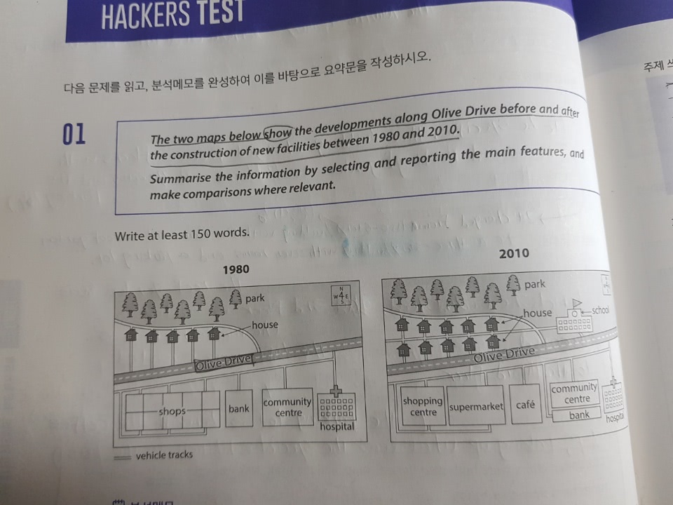
The two maps show striking advancements around Oliver drive over three decades.
Overall, it is apparent that there were significant changes on both sides. In particular, a variety of useful establishments were built up.
Looking at the two maps more closely, one can see that the number of housing units doubled from 1980 to 2010. Hence, a school was constructed next to many houses, connecting to Olive drive and two vehicle tracks on the north side. Whereas, on the south side, lost of shops were originally occupied in the same building in 1980, but these were divided into a shopping centre, a supermarket and a cafe. In addition, a bank was situated between shops and the community centre. 30 years later, it was relocated to behind the community centre in 2010. Then, the scale of community centre in 2010 notably decreased compared to in 1980. Lastly, a hospital's location remained unchanged over 30 years. (154 words)
항상 감사합니다. 비밀번호는 1234입니다.

 댓글 0개
댓글 0개


 불편사항 신고