


 인쇄
인쇄


답안
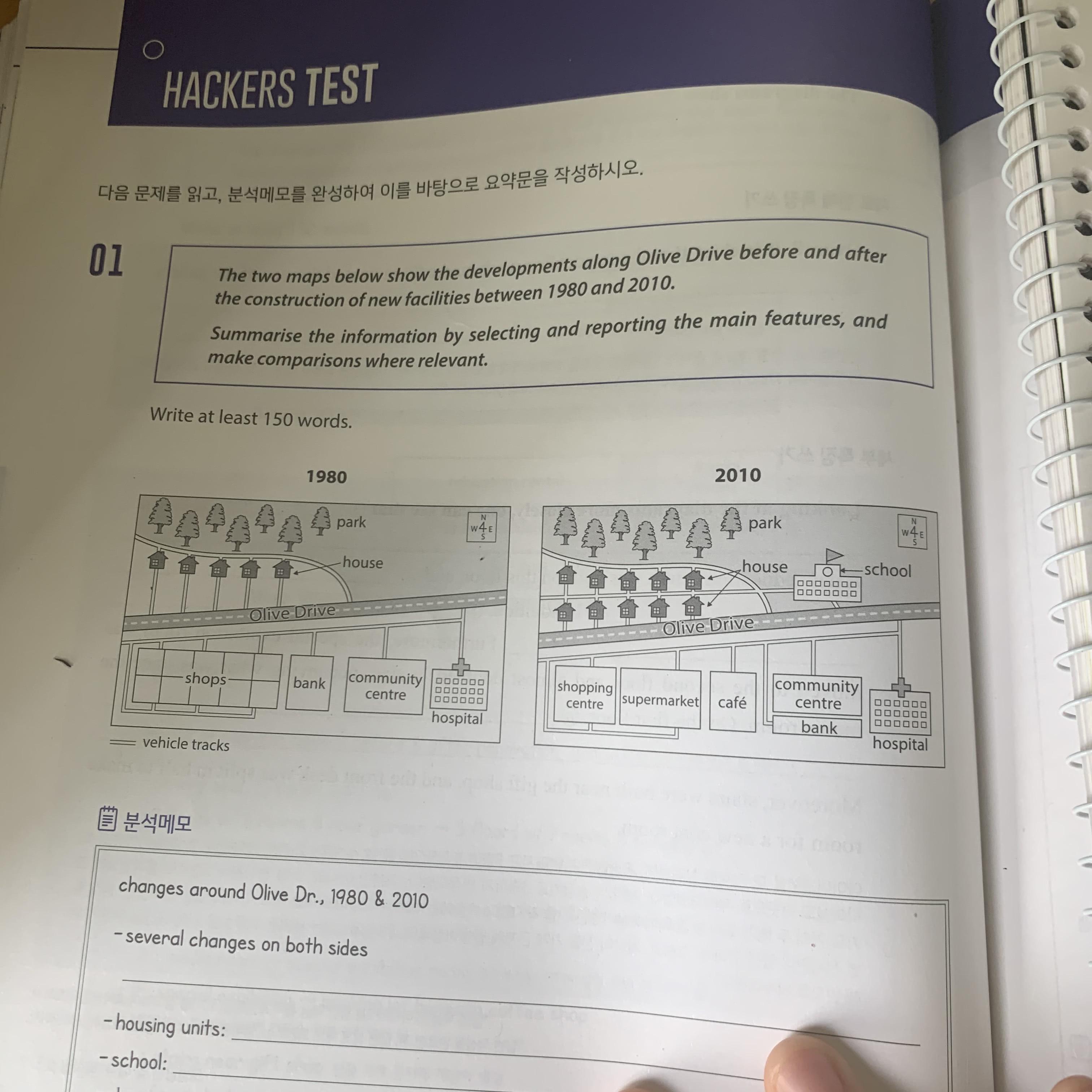
The maps show the changes around Olive Drive from 1980 to 2000. Many new facilities were constructed during this period. (서론에서는 변화가 아닌, 딱 표의 내용에 대한 소개만 해주시면 됩니다.)
Overall, the number of houses increased and a school was newly built. The location of some facilities also changed.
Looking at the maps more closely, one can see that 5 houses were additionally constructed in 2010 on the south side of the original five houses of 1980. Also a the school was built next to the houses. A new vehicle track between the houses was linked to the school. The original place of the bank changed to a cafe. The bank moved to the south side of the community centre. (여기의 세 문장은 전혀 매끄럽게 이어지지 않는 상황이라서, 연결어를 넣거나 해서 조금 더 자연스럽게 이어주시면 좋습니다.) In 2010, the size of the community centre became almost two-thirds of the original size. Furthermore, in 1980, on the west side of the bank, there had been many shops, but these shops were combined into the shopping centre and the supermarket in 2010. Unlike other facilities, the location or the size of the hospital did not change.
20분 동안 작성했고, 비밀번호는 1234 입니다. 항상 감사드립니다 ㅠㅠ!
총평: (6/6/6/7) 6.5
지금과 같이 마지막 문단에 모든 변화를 몰아넣는 구조를 유지한다는 가정 하에 관사에 관해서 말씀드리겠습니다. 이건 그냥 외우시면 돼요.
1. 시간상 앞선 지도의 건물 등은 the를 붙여주시면 됩니다.
2. 시간상 뒤따르는 지도의 건물이 처음 언급될 때에는 a(n)를 붙여주시면 됩니다.
3. 2번의 건물이 두 번째 이상으로 언급될 때에는 the를 붙여주시면 됩니다.
이렇게 가면 99%는 문제 없으니까, 지도 문제 관사는 딱 여기까지만 들어가세요!
수고하셨습니다 :)

 비밀번호 확인
 댓글 0개
댓글 0개


 불편사항 신고