


 인쇄
인쇄


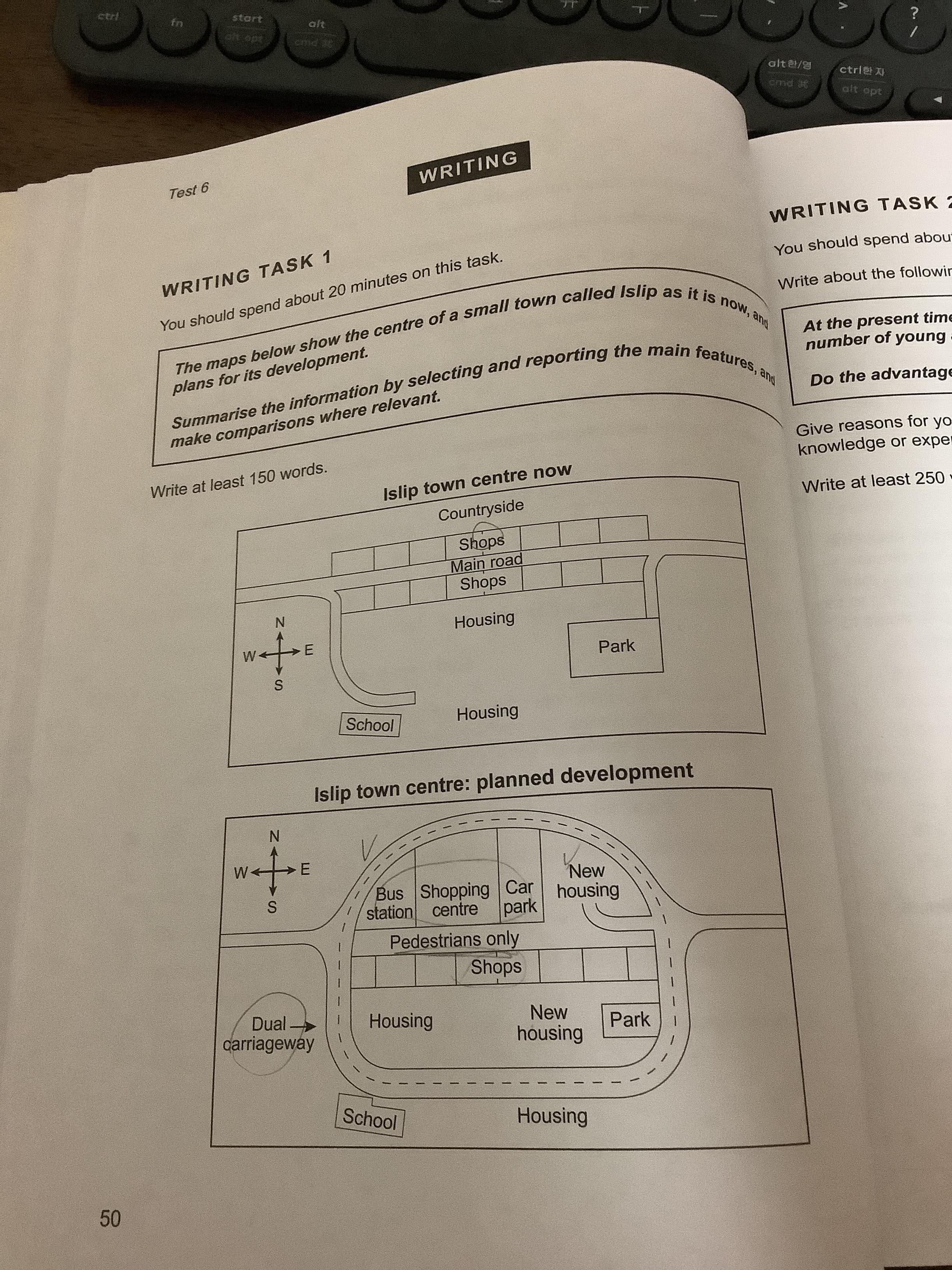
The given maps show the present and planned forms of the center of the small town which is called Islip. There are several changes between two images. Overall, dual carriageway will be built around the center of the town and northern shops are going to be divided into many facilities and housing in the future.
First, the most notable feature compared with two images, the roads that formed across the center of the town will be build to dual carriageway and it will wrap the center. Housing will be developed in the carriageway and the size of the park will be decreased. Main road which divides shops into north and south will be changed into the road that only pedestrians can go.
The northern shops are going to be smaller and the bus station and car park will be developed. Besides the car park in planned development, housing will be positioned newly where the shops are located now. School will be remained in the same location out of the dual carriageway and the Islip town center will be formed like circle-shape.

 댓글 0개
댓글 0개


 불편사항 신고