


 인쇄
인쇄


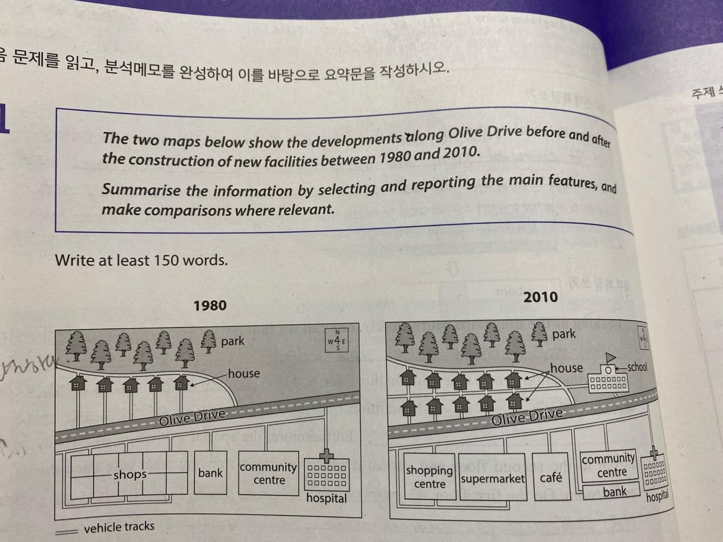
The two maps illustrate the changes around Olive Drive from 1980 to 2010.
Overall, it is clear that there are several changes on both sides of Olive Drive between 1980 and 2010. Many facilities and buildings were constructed for educational, commercial, and residential purposes.
Looking at the maps more closely, one can see that five houses were added in 1980 were added as ten houses in the year 2010, showing a total sum of ten houses. Housing units were built near the park located in the northwest side of Olive Drive and a new school was constructed on the east side of the residential area. Moreover, many small shops located in the south west of Olive Drive were replaced by a large shopping centre Centre and a supermarket. The community centre Centre was reduced in space to make room space for the bank, which was moved to an area behind community centre Centre. The former bank space of the bank was taken built by a café. In addition, the hospital next to the community centre Centre and the bank remained unchanged from 1980 to 2010.
글자수: 164 / 소요시간: 18분 / 목표점수: 6.0
TASK1 첨삭 부탁드립니다:)
감사합니다!!!
총평: (7/6/6/6) 6.5
표현상의 자잘한 오류가 있긴 하지만, 그래도 5점대 떨어질 글은 당연히 아닙니다. Aille님의 경우 제가 6.5까지는 확답을 드리지 못하겠지만, 6.0은 무조건 받으실 겁니다. 고로 편하게 공부하시되, 자만하지는 마시고 꼭 문법을 꾸준히 보완해주세요!
수고하셨습니다 :)

 비밀번호 확인
 댓글 0개
댓글 0개


 불편사항 신고