


 인쇄
인쇄


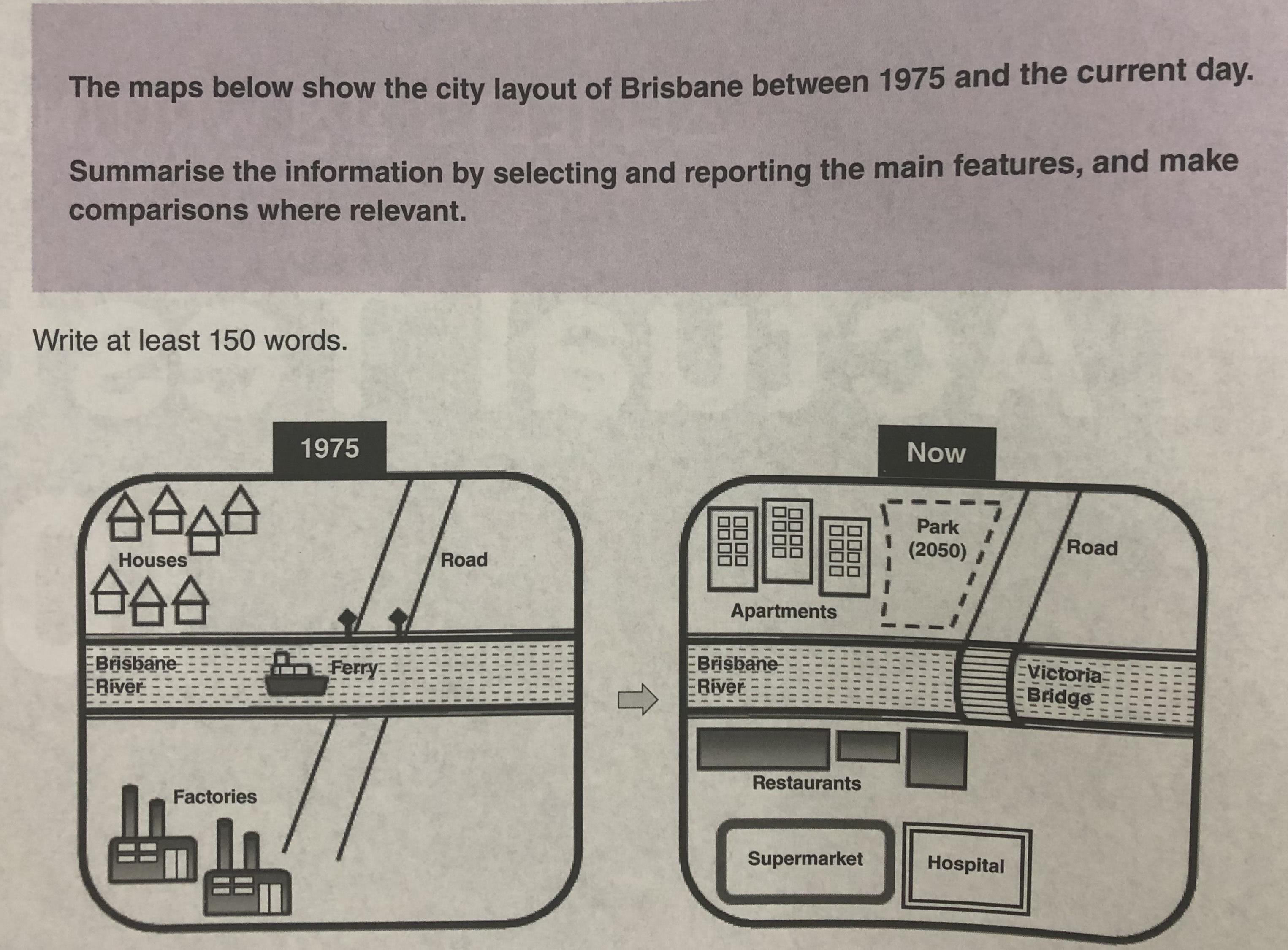
The maps below illustrate the changed layout of Brisbane from 1975 to the present. Overall, Brisbane changed into a city appropriate for a living. In current day, many convenient facilities are located in the city comparing to its environment in 1975.
According to the maps, the most noticeable change was happened on Brisbane River. There was no bridge on the river in 1975 so that people couldn’t across the river without a ferry. However, as a bridge named Victoria was constructed on Brisbane river, people who live on the upper side of river can visit facilities that are located on the downside of river nowadays.
Moreover, the type of city has been changed into a living town. While Brisbane was a city for industrial factories in 1975, as time goes by, the city has become a residential city with convenient infrastructures. On the downside of river, there are restaurants along the river and a supermarket and a hospital behind these restaurants. In addition, on the upper-side of river, a park will be built in front of apartments in 2050.
첨삭감사합니다!

 댓글 0개
댓글 0개


 불편사항 신고